Geodetically Anchored 0.30m Digital Elevation Model of the Chandrayaan-3 Vikram Landing Site from Chandrayaan-2 Orbital High Resolution Camera (OHRC) Stereo Imagery
Geodetically Anchored 0.30m Digital Elevation Model of the Chandrayaan-3 Vikram Landing Site from Chandrayaan-2 Orbital High Resolution Camera (OHRC) Stereo Imagery
Chandra Tungathurthi
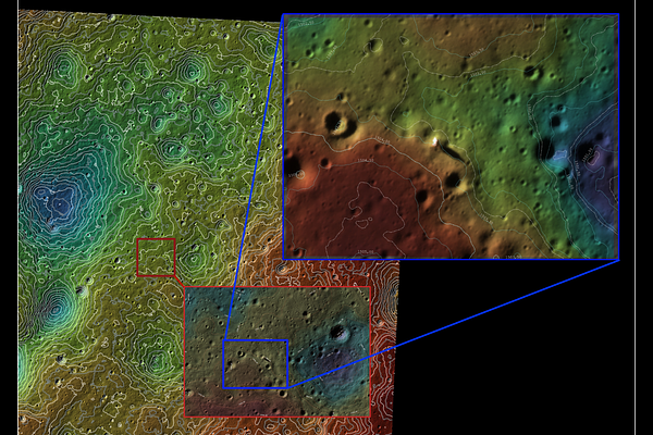
AbstractISRO's terrain characterization and hazard mapping from Chandrayaan-2 Orbiter High Resolution Camera (OHRC) stereo imagery were central to the safe landing of Chandrayaan-3 - the first successful landing in the lunar south polar region. However, these elevation products were generated with a proprietary pipeline and have not been publicly released. We present a 0.30 m/pixel digital elevation model (DEM) of the Chandrayaan-3 Vikram landing site using a fully open workflow based on ISIS, the Ames Stereo Pipeline, and ALE, achieving sub-meter resolution comparable to mission-reported products. The reconstruction covers 2.18 x 2.24 km with 91.2% valid pixel coverage, 8.1 cm median triangulation error, and 40-50 cm relative vertical precision. The Vikram lander and Pragyan rover are individually resolved. Geodetic alignment to an LROC NAC stereo DEM achieves approximately 30 m horizontal accuracy; pixel-wise validation at 3 m resolution confirms negligible vertical bias (median dz = +0.28 m) and robust dispersion (NMAD = 2.88 m). Stable OHRC stereo convergence requires Community Sensor Model (CSM) camera models; the legacy ISIS camera model failed across two independent sites. At 0.30 m, these DEMs complement LROC NAC DTMs (approximately 1 m), resolving sub-meter hazards below the NAC detection threshold. Applied to the extensive OHRC south polar archive, this methodology provides independent capability for hazard mapping and landing site analysis for upcoming missions including Chandrayaan-4, LUPEX, and Artemis.